


 , Rajib Shaw2, Md Anwarul Abedin3, Salvano Briceno4, Amod Mani Dixit5, Manu Gupta6, Wim Hugo7, Jia Gensuo8, Virginia Murray9, Aung Myint10, Joy Jacqueline Pereira11, Atta-ur Rahman12, Vinod K.Sharma13, Sugeng Triutomo14, Wang Xiaoqing15, Deepthi Wickramsinghe16
2. IRDR IPO, Beijing 100094;
3. Department of Soil Science, Bangladesh Agricultural University, Mymensingh-2202;
4. IRDR Science Committee, Divonne-les-Bains F-01220;
5. National Society of Earthquake Technology-Nepal(NSET), Kathmandu 13775;
6. Asian Disaster Reduction & Response Network, New Delhi 110022;
7. South African Environmental Observation Network, Pretoria, 0001;
8. Key Lab of Regional Climate-Environment for East Asia, Chinese Academy of Sciences, Beijing 100029;
9. UNISDR Scientific and Technical Advisory Group(STAG)/Integrated Research on Disaster Risk/Public Health Consultant in Global Disaster Risk Reduction, Public Health England, London SE1 8UG;
10. Myanmar Engineering Society, Yangon Anwarul 11011;
11. SEADPRI-Universiti Kebangsaan Malaysia, Institute for Environment and Development, Bangi 43600;
12. Department of Geography, University of Peshawar, Khyber Pakhunkhwa 25140;
13. Indian Institute of Public Administration, New Delhi-110002;
14. Center for Disaster Studies, Defense University, Indonesia 10150;
15. Institute of Earthquake Science, China Earthquake Administration, Beijing 100036;
16. Department of Zoology and Environment Sciences, University of Colombo, Colombo 00700
The Belt and Road Initiative involves more than sixty countries, representing more than one third of the world economy and more than half of world population. This also is the very region that experiences over 85% of the world's natural hazard events having serious impacts on human populations. The Belt and Road region represents the majority of the world's disaster deaths and losses. Given the rapid urbanisation and continued population growth trend, the challenges faced by the region are only due to increase in the future. The Disaster Risk Reduction theme is thus very appropriate to be a key area of work in the region, bringing together multiple stakeholders from the concerned countries to address the risk of disasters arising out of natural hazards, climate change and technological accidents. "Digital Belt and Road" (DBAR) initiative has been formulated in 2016. DBAR is in agreement with and in support of agreed global frameworks that include the Sendai Framework for Disaster Risk Reduction, the Sustainable Development Goals and the Paris Agreement on climate change. Under the DBAR framework, DBAR, jointly with Integrated Research on Disaster Risk (IRDR) International Programme Office (IPO), IRDR China National Committee (IRDR CHINA), Institute of Remote Sensing and Digital Earth (RADI), International Society for Digital Earth (ISDE), and CAS-TWAS Centre of Excellence on Space Technology for Disaster Mitigation (SDIM) conduct an international research programme and DBAR Disaster Risk Reduction Working Group (DBARDISASTER) is formed to strengthen science capacities for sustainable development and disaster risk reduction, starting from year 2016. The First Consultative Workshop of the DBAR Regional Research Platform for Disaster Risk Reduction took place in December 1–2, 2016 in Sanya, China. Towards the end of the workshop, a DBAR DRR Working Group was formed and it identified the opportunity to promote scientific implementation of the United Nations' Sendai Framework for Disaster Risk Reduction 2015–2030 along the Belt and Road. The disaster risk reduction approach taken by the DBAR-DISASTER covers Satellite and Information and Communication Technologies, Implementation Oriented Technologies that involve hardware solutions to risk reduction challenges; Process Technologies that are concerned with decision making, collaboration and people's engagements; and also the Transferrable Indigenous Knowledge that banks on traditional wisdom that most countries of the region are very rich in.
The Sendai Framework for Disaster Risk Reduction 2015-2030 and DBAR DRRThe Sendai Framework for Disaster Risk Reduction 2015–2030, was adopted by Member States on 18th March 2015, at the World Conference on Disaster Risk Reduction (DRR) held in Japan, and endorsed by the UN General Assembly in June 2015. The Sendai Framework promotes shifting focus from managing disasters to managing risks. This requires a better understanding of risk in all its dimensions of vulnerability, exposure, and hazards. It aims to ensure that the multi-hazard management of disaster risk is factored into development at all levels as well as within and across all sectors. The Sendai Framework is wide in scope. It applies to the risk of small-scale and large-scale, frequent and infrequent, sudden, and slow-onset disasters, caused by natural or man-made hazards as well as related environmental, technological, and biological hazards and risks.
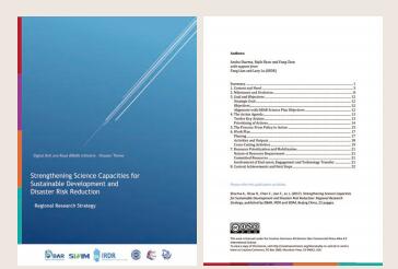
The call for enhancing the scientific and technical work on disaster risk reduction and its mobilization through the coordination of networks and scientific research institutions at all levels and in all regions, such as the Chinese Academy of Science's new Digital Belt and Road Initiative, with the support of the United Nations Office for Disaster Risk Reduction Scientific and Technical Advisory Group (Figure 1), has been made in order to
|
| Figure 1 Release Regional Research Strategy for DRR |
●Strengthen the evidence-base in support of the implementation of the present Framework;
●Promote scientific research on disaster risk patterns, causes and effects;
●Disseminate risk information with the best use of geospatial information technology;
●Provide guidance on methodologies and standards for risk assessments, disaster risk modelling, and the use of data;
●Identify research and technology gaps and set recommendations for research priority areas in disaster risk reduction;
●Promote and support the availability and application of science and technology to decisionmaking;
●Use post-disaster reviews as opportunities to enhance learning of public policy and disseminate studies.
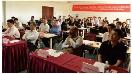
The International Training Workshop on Strengthening Science Capacities for Sustainable Development and Disaster Risk Reduction was successfully kicked off in the Sanya Campus of the Institute of Remote Sensing and Digital Earth (RADI) of the Chinese Academy of Sciences (CAS) on November 28, 2016 (Figure 2). The event was co-organized by the "Digital Belt and Road" Initiative (DBAR), CAS-TWAS Centre of Excellence on Space Technology for Disaster Mitigation (SDIM), Integrated Research on Disaster Risk (IRDR) International Programme Office (IPO), IRDR China National Committee (IRDR CHINA), Institute of Remote Sensing and Digital Earth (RADI), International Council for Science World Data System (ICSU-WDS), and International Society for Digital Earth (ISDE). The workshop centered on disaster risk reduction in developing countries along the Belt and Road, and combined theories, methods, and practices within the framework of the "Digital Belt and Road" (DBAR) to improve the capacities of young scholars and management staff from relevant countries for sustainable disaster risk reduction. More than 20 trainees attended the workshop from 15 developing countries, including Bangladesh, Myanmar, Pakistan, Thailand, Mongolia, Malaysia, Sri Lanka, Vietnam, India, and Morocco.
|
| Figure 2 International participants attend the training workshop |
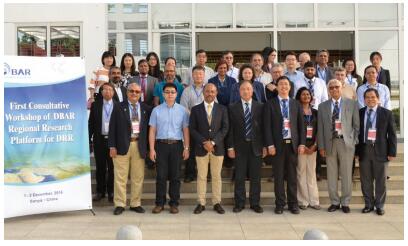
DBAR Disaster Risk Reduction Working Group was form at the First Consultative Workshop of the DBAR Regional Research Platform for Disaster Risk Reduction in December 2016. It identified the opportunity to promote the scientific implementation of the United Nations' Sendai Framework for Disaster Risk Reduction 2015–2030 along the Belt and Road and also offered the opportunity to set priorities for scientific cooperation for disaster risk reduction for the Digital Belt and Road Initiative (Figure 3), and in-depth discussions were held that addressed issues such as
|
| Figure 3 Launch of DBAR-DISASTER Risk Reduction Working Group |
●Characterising the demand for science and technology;
●Considerations of new concepts and practical technologies for disaster risk reduction;
●The need to develop more comprehensive strategies on disaster risk reduction.
In order to help to implement the Digital Belt and Road Initiative the proposed priorities are linked to relevant paragraphs in the Sendai Framework for Disaster Risk Reduction 2015–2030. Implementation of these priorities should enhance future preparedness, response, recovery, and rehabilitation from local, national, regional to global disasters for the Digital Belt and Road Initiative community.
Disaster Risk Reduction of DBAR in Different Countries Bangladesh

|
| Md Anwarul Abedin, Bangladesh Agricultural University Professor |
Bangladesh is a low-lying deltaic country in South Asia created by the Ganges, the Brahmaputra, and the Meghna rivers system. The geographical location, land characteristics, multiplicity of rivers, and the monsoon climate solidify Bangladesh highly vulnerable to natural hazards and its consequences. Natural and human induced hazards such as floods, cyclones, droughts, tidal surges, tornadoes, earthquakes, river erosion, fire, infrastructure collapse, high arsenic contents of ground water, water logging, water and soil salinity, epidemic, and various forms of pollution are frequent occurrences that directly or indirectly cause economic loss and death toll. Climate change adds a new dimension to community risk and vulnerability through climate stressed conditions. Although the magnitude of these changes may appear to be small, they could substantially increase the frequency and intensity of existing climatic events (floods, droughts, cyclones, etc.). Bangladesh is doing well and open new avenue in disaster response and recovery to save human lives largely due to its excellent trained volunteers' networks in the disaster prone areas, but at the same time, disaster risk to economy is rising sharply. Bangladesh is a natural disaster prone country. Hence, it is imperative that an effective system should be developed to combat such situation to mitigate the effects of disaster in a scientific and sustainable manner. In this contrast, the Belt and Road Initiative will involve more than 60 countries and Bangladesh is one of them among others. DBAR initiatives support application of big earth data set in association with social vulnerability data for country specific disasters and risks assessment for disaster resilient community. DBAR initiatives also contribute to the generation of relevant information to support informed decision-making regarding risk and vulnerability reduction and to address the underlying factors of disaster risk in the Belt and Road through science and technology intervention in Bangladesh.
India

|
| Vinod Kumar Sharma, Indian Institute of Public Administration Professor |
India has very robust disaster management system with National Disaster Management Authority (NDMA) headed by the Prime Minister. At State level, State Disaster Management Authorities (SDMA) headed by respective Chief Ministers. Even district level there are District Disaster Management Authorities (DDMA). There is National Institute of Disaster Management (NIDM) for the capacity building of all stakeholders. There are more than 100 scientific and academic institutions working for disaster risk reduction and providing support to the policy makers. India has disaster Management Act passed in 2005 and a National Policy developed in 2009. There are specific guidelines for each disasters developed by the NDMA. The country has a unique search and rescue force, National Disaster Response Force (NDRF) which is located at various vulnerable locations to assist state authorities at the time of disaster. But still the country needed more scientific and technological cooperation from other countries facing similar disasters. The DBAR DRR initiative with 'Big Earth Data' can certainly act as Knowledge Management hub for DRR and climate change adaptation and assist over 60 the Belt and Road countries in capacity building, providing common guidelines for scientific and technological research, sharing experiences, lessons learned, developing their action plans and short and long term strategies for disaster mitigation and risk reduction. As most of DBAR countries have signed the 'Sendai Framework' for 2015–2030; Sustainable Development Goals (SDGs) for 2015–2030; and Paris Agreement on climate change in 2015, it will be easy to work together for a common goal of DRR and reducing economic and life loss in this region by having a strong scientific and technological base. Science and Technology Plan for DRR is a good instrument to use national S&T knowledge and capacity in disaster preparedness and mitigation. It is win-win situation for all the partner countries for reducing disaster risk and improving trade and ultimately their economy.
Indonesia
|
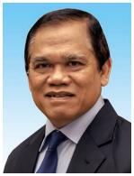
| Sugeng Triutomo, Indonesia Center for Disaster Studies Professor |
Indonesia is one country that is located in the "Belt and Road" to have a major challenge in the face of disaster. Because the country is located in the junction of three giant tectonic plates namely Eurasian, Indo Australia, and the Pacific, some natural hazards such as earthquake, tsunami, volcano eruptions, and some subsequence hazards are often occurring in this area.
Maritime Silk Road that crossed the Indian Ocean have challenges in the field of disaster as happened in 2004, the Indian Ocean Tsunami catastrophe. Regional cooperation in this region is very important to overcome problems that occur in this region. Therefore, some cooperation in some field have been done like the Indian Ocean Tsunami Early Warning System (IOTEWS) and the Indian Ocean Rim Association (IORA).
Regional cooperation along the Belt and Road Initiative can be increased among the countries located in this path through the cultural and scientific exchanges and partnerships, including disaster risk reduction.
Digital Belt and Road (DBAR) Initiative as an international research program can be a platform in regional cooperation, especially in the field of earth observation. The objectives of DBAR DRR are expected to address disaster risk reduction in the Belt and Road, particularly in achieving the goals of Sendai Framework for Disaster Risk Reduction.
In particular DBAR DRR will focus on priority #1 of Sendai Framework (SFDRR) which is Understanding Disaster Risk. The objectives of DBAR DRR meet with the priority to promote and enhance, through international cooperation, including technology transfer, access to and the sharing and use of non-sensitive data and information, as appropriate communications and geospatial and space-based technologies and related services.
Associated with global and international cooperation, in SFDRR emphasized the importance of regional cooperation to achieve the goal of disaster risk reduction. Therefore, in addressing disparity in technological innovation and research capacity among countries in DBAR, it is crucial to enhance technology transfer, involving a process of enabling and facilitating flows of skill, knowledge, ideas, know-how, and technology from developed to developing countries.
Malaysia

|
| Joy Jacqueline Pereira, Fellow of the Academy of Sciences Malaysia |
The Malaysian Government is taking serious consideration of climate-driven hazards such as floods, flash-floods, and landslides. A high-level Scientific Expert Panel on Disaster Risk Reduction has been established, overseen by the Science Advisor to the Hon. Prime Minister of Malaysia and the National Disaster Management Agency (NADMA), which reports directly to the National Science Council chaired by the Prime Minister of Malaysia. The ultimate goal is to mobilize science for societal well-being, with a particularly focus on the bottom 40% income group in the country, who are vulnerable and exposed to disasters. Satellite based spatial data and technologies could contribute greatly to understanding of extreme climate risks and coordination of efforts to enhance resilience. The challenge is to complement such efforts with context and area specific information that bridges disaster risk reduction and climate change adaptation at the local level.
Risk reduction at the local level requires situational recognition of fast and slow onset hazards as well as its cascading effects with respect to its extent, long-term physical impacts, and economic losses as well as limits to adaptation. In addition, the scale of scientific information should match the decision-making scale at the local level. It is also important that scientific inputs be synchronized to local administrative processes so that mainstreaming and implementation is effective at the city level. Local level information is also critical to ensure the effectiveness of early warning and response systems. Enhanced local level datasets and modelling capacity has the capacity to reveal precise exposure zones at the neighborhood scale. This is particularly important for national and multi-national insurers who need to be able to demonstrate to re-insurers that the risk of hazards, particularly for floods and landslides has been understood and properly considered. This is also important for governments in developing and middle income countries of the Digital Belt and Road Initiative, who will ultimately become insurers as a last resort.
Myanmar

|
| Aung Myint, Myanmar Engineering Society President |
Myanmar is one of the countries which are facing common disaster risks and often trans-boundary mega disaster threat along Belt and Road and it is very important to develop multi-hazard management approaches within the framework of B&R Initiative. Most of the existing roads in Myanmar especially in rural or remote areas need to upgrade because some roads are very narrow and difficult to use in disaster time. If new development infrastructures are constructed, adaptation and preparation for disaster risk reduction should be integrated and implemented. Protection of Embankment and River Bank Erosion in Myanmar is taken by Irrigation Department. Most of the big cities and famous and historical cities are situated along Ayeyawaddy River, it is very vulnerable area of flood and high erosion because of its topography. The maintenance for embankments is major (raising more level of dike) and minor (regular checking) system based on their Department's budget.
Currently, the New Myanmar Action Plan on Disaster Risk Reduction with the overall objective is to seek technical inputs as well as engage wider range of stakeholders in drafting of the New MAPDRR, the Task Force has decided to constitute Technical Working Groups (TWGs) including government departments, academic, INGO, NGO, and other technical organizations. We are highly resolution that we can solve our changes of extreme climate and related disaster risk along the Belt and Road by using satellite based spatial data and technologies to reduce climate change and disaster risks as part of the Digital Belt and Road Initiative.
Nepal
|
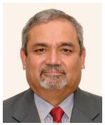
| Amod Mani Dixit, National Society of Earthquake TechnologyNepal Executive Director |
Nepal is a landlocked country, surrounded by India from the east, west and south, and China from the north. Nepal is one of the most disaster-prone countries in the world and has experienced several natural catastrophes causing high economic and human losses. Heavy rain and storms cause severe flooding, or trigger landslides that have an enormous effect on property, structures, and lives. On the other hand, during the dry season, Nepal is prone to fire and draught. Moreover, Nepal is prone to other disastrous events like epidemics and pollution. The country is still trying hard to build back better more than 800, 000 houses and public structure that were damaged by the devastating Gorkha earthquake sequence of 2015 that took a toll of about 9, 000 lives and caused injury to more than 20, 000 people. The impact of global climate change is more readily visible in the form of melting of glacier ice and increasing potential of glacier lakes outburst floods (GLOFs) along the northern border with China; GLOFS have been recorded as causing great loss of life and damage to physical infrastructures and property.
Although not directly in the ancient Silk Road, Nepal is connected to the Silk Road through the Tibet region of China. In the Belt and Road concept, Nepal is considered having a great potential of serving as a gateway into the rest of South Asia. Digital Belt and Road (DBAR) is the international research program for promoting scientific and technological cooperation among countries along the Belt and Road Initiative. The following five are the preliminary thoughts on the possible strategic directions for Nepal to plan to benefit from the DBAR program.
(1) Use of big earth data for in support of (a) mapping and joint research of natural hazards (landslides, debris flows, and glacier lakes outburst floods (GLOF)), and other hazards and environmental conditions and their monitoring leading to development of thematic hazard, climate change, and social economic vulnerability atlases of the Himalayas, and (b) conduction of joint study and research on disaster risk reduction along the prescribed priorities of action as defined by the SFDRR.
(2) Joint and collective researches on hazard risk mitigation, such as benefit cost ratio of disaster risk mitigation, to achieve the integrated risk atlas, and conduction of pilot projects on disaster risk reduction in the Himalayas.
(3) Promote the scientific collaboration between scientific and research institutions of China and Nepal.
(4) Exchange of young scientists through creation and promotion of Youth Volunteer or Youth Internship Programs for the youth of the two countries in scientific institutions.
(5) Assistance in development of science and technology plan for DRR in Nepal. IRDR has been encouraging the IRDR/ICoE NSET and others to go ahead with the development of a science and technology plan for DRR for Nepal. DBAR could greatly help in accomplishing this task by initiating this as a Nepal component of DBAR.
Pakistan
|
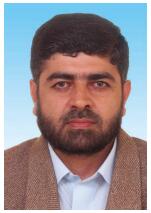
| Atta-ur Rahman, University of Peshawar, Pakistan Associate Professor |
Pakistan has a long history of wide range of natural and human-induced disasters including geophysical events to hydro-meteorological phenomenon. It is climate change which has further exacerbated the hydro-meteorological events. In Pakistan, almost every year, the impacts of disasters put extra pressure on the country meager budget. The recent disasters have further convinced the decision-makers to mainstream DRR in planning, policy, programmes, and strategy formulation. Nevertheless, to make a country more resilient to frequent disasters, attention need to be given to cross-sectoral and multi-scale DRR approach.
Contribution of DBAR from the perspective of Pakistan DBAR-DISASTER community:
In the Belt and Road countries, trans-boundary disasters are challenging area. In order to cope with trans-disasters, the DBAR platform would be the most suitable platform (taking the cursory examples of recent mega trans-boundary disasters such as floods in the Hindukush and Himalayan region, 2010 heat waves, 2005 Kashmir earthquake, 2004 Indian Ocean Tsunami etc.). The DBAR Disaster platform may work on this challenging area.
The countries in the Belt and Road region may take full advantage of big earth digital data to use and apply while working on DRR. There is increasing trend in application of space born data in DRR and climate change research. The DBAR-DISASTER working group may extend liaison and develop collaborative linkages with the Belt and Road countries to use and apply space born data.
The China Pakistan Economic Corridor (CPEC) is an ongoing mega development project in Pakistan, aims to connect Gwadar port (south of Pakistan) to China via Silk Road through a network of highways, railways, and pipe lines. The gross total cost of CPEC projects is worth $54 billion. This project will help in benefiting remote areas and will further strengthen emerging socio-economic cooperation in the Belt and Road countries. CPEC is exposed to wide range of geophysical and hydro-meteorological disasters. This need to be studied as a pilot integrated project under the Belt and Road Initiative. In the DBAR countries, the CPEC as an integrated case study region/sample that would reflect various opportunities and challenges involved in Belt and Road Initiative, and CPEC could serve as a common platform for DBAR pilot researches that link various DBAR schemes/WGs together.
South Africa

|
| Wim Hugo South, African Environmental Observation Network Chief Officer |
South Africa is not generally subject to the typical large-scale disasters experienced in Asian countries. This is due to seismic stability (earthquakes that impact humans and tsunami events are very rare) and relatively dry, stable weather patterns. Short-term disasters that do occur are usually the result of localized flooding or fire events-the latter being very frequent in the dry season (Oct–Mar in the winter rainfall regions, and Apr–Sep in the summer rainfall regions). The only large-scale disaster of consequence is drought: a recurring feature with more or less decadal frequency, and while the immediate impacts on human lives and livelihoods are not severe, prolonged drought, such as being experienced at present, has significant consequences in the medium term. Impact is largest in poor communities that are reliant on subsistence farming, and while food security is not generally impacted, quality of life and wealth (held in many rural areas in the form of cattle stock) are often affected over a period of two to three years.
South Africa has well-established mechanisms for dealing with disasters: national government can release funding on declaration of a disaster from contingency earmarked for the purpose, and the criteria whereby such disasters are declared are well defined. Medium-and long-term risks and vulnerabilities are less well managed, and with this in mind, the Department of Science and Technology is sponsoring the development and maintenance of the South African Risk and Vulnerability Atlas (SARVA), aiming to bridge the gap between global change research and policy or decision support in respect of mitigation, adaptation, and improved resilience.
There is a considerable expectation that research output, being increasingly open, standardized, and managed in formal research data infrastructure, will be useful to policy and decision makers without much additional intervention and modification. We believe that this is unlikely to be feasible in the majority of cases. For most instances, it will be necessary to provide a framework for the translation of scientific output into decision and policy support metrics or indicators at a frequency, with spatial and temporal resolution, and thematic coverage that suits the decision to be made. Such frameworks exist, since the need has been identified-sometimes formally-such as the very detailed framework developed by IPCC for translating climate science into policy-(IPCC, 2007), or less formally-such as the move to develop Essential Biodiversity Variables, loosely designed to support Aichi Targets or the UN Sustainable Development Goals.
SAEON is in the final stages of preparing and publishing such a framework for risk and vulnerability assessment in the immediate, medium, and long term. DBAR DRR would be an important contributor to disaster risk reduction in South Africa.
Sri Lanka

|
| Deepthi Wickramsinghe, University of Colombo, Sri Lanka Professor |
Sri Lanka is a small island in the Indian Ocean and lies in the Belt and Road area where hosts over 85% of the world's disaster events resulting highest number of deaths and losses. Extremes of the water cycle affect Sri Lanka frequently. Floods occur often due to monsoonal rain or effects of low pressure systems and in the other extreme droughts are apparent due to failure of rains. Sri Lanka is also prone to hazards such as landslides, lightning strikes, coastal erosion, and bushfires. Tropical cyclones also hit mostly the northern region of the island. In 2004, almost two-thirds of the Sri Lankan coast was affected by the Indian Ocean tsunami which was an eye opener on the country's vulnerability to low-frequency but high impact events.
Compared with the rest of the world, the mortality weighted multi-hazard map prepared for the country revealed that a significant risks exist to the entire country. Most importantly, disaster impacts are more evident in Sri Lanka's southwestern region where major commercial and other socio economically sensitive places are concentrated. Moreover, being an island nation, the impacts of climate change which further aggravate the intensity and frequency of disasters could not be ignored. DBAR's intention to promote cooperation with countries along the Belt and Road route to practice the smart use and application of `Big Earth Data' is potentially of immense value, since it is increasingly evident globally that the use of such data sets to enhance disaster resilience can contribute to Sri Lanka for the implementation of the Sendai Framework in many ways.
International organizations

|
| Gensuo Jia, Chinese Academy of Sciences Professor |
|
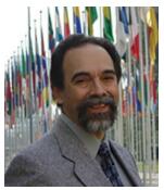
| Salvano Briceno, IRDR Science Committee Member |

|
| Manu Gupta, Asian Disaster Reduction & Response Network Chair |
Most countries along the Belt and Road are vulnerable to extreme climate and disasters. The world has centuries of experience in managing the risks of disasters but very little experience with risks due to climate change. As scientists accumulate more and more data on the inevitability of extreme weather due to climate change, it is important to understand how to reduce disaster risks that are directly or indirectly caused by changing climate extremes. The risks of climate extremes and damages from extremes have already increased. Impacts depend on the nature and severity of events, vulnerability and exposure. Disaster risk results from the overlap of these three drivers. For exposed and vulnerable communities, even non-extreme weather and climate events can have extreme impacts. From 1960 to 2015, more than 95 percent of disaster deaths occurred in developing countries. However, economic losses due to severe weather are much higher in developed countries, with many of them located along the Belt and Road.
As we are facing common disaster risks and often trans-boundary mega disaster threat along the Belt and Road, DBAR efforts on disaster risk reduction must be better coordinated cross nations and sectors. Multi-hazard management approaches within the framework of B&R Initiative are needed to develop, to coordinate DRR actions from local (e.g., major B&R infrastructure projects) to regional levels (e.g., bilateral and multi-lateral cooperation mechanisms), and to develop and iterative approach based on potential co-benefits with climate change adaptation strategies.
Managing and reducing climate and disaster risks will require developing an appropriate institutional or governance framework to address risk as a priority, at the regional level as well as for each participating country. Risk governance includes policy, legislation, and organizational arrangements focusing on risk reduction, as well as climate risk impact assessments as a major risk management tool for each of the Belt and Road investments.
There are still major scientific uncertainties on direct connection between climate change and some specific disaster risks, as well as future changes of extreme climate and related disaster risks along the Belt and Road. However, reducing risk and vulnerability remains the most effective preventive and precautionary measure, as well as a major contribution to sustainable development of the B&R region. Satellite based spatial data and technologies, especially big earth data approaches, are an essential tool for improving our understanding of extreme climate risks, and for coordinated efforts to reduce climate change and disaster risks as part of the Belt and Road Initiative.
In addition, with strong roots and engagement, local Civil Society Organizations (CSOs) are often best positioned to work with communities who are on the margins and have to bear the maximum brunt of disasters. Considering the complexity of problems at local level, there are needs to evolve integrated approaches that contribute to long term resilience and sustainability of local communities. The DBAR DRR with its unique research focus and linkage between institutions along the Belt and Road is an excellent opportunity for local CSOs to partner with institutions of higher learning and research. The DBAR DRR can potentially create upstream connections between communities and scientific institutions by assessing needs of disaster threatened communities on a near real-time basis; and finding solutions that are locally adaptable and acceptable.
ConclusionsDBAR-DISASTER aims to foster the use of big earth data through existing and emerging mechanisms, and to contribute to a better and more integrated use of such technologies in DRR around the Belt and Road region. Through the collaboration in the disaster risk reduction domain in the Belt and Road region, DBAR-DISASTER plans to
●Promote innovative, need based implementation oriented research on science and technology, using big earth data, specifically in the field of DRR;
●Facilitate the dialogue among stakeholders in Earth observation, data, and the community of DRR experts and policy makers in Belt and Road region, including by the compilation and exchange of lessons identified regarding the use of such sciences and technologies;
●Serve as a collective source and repository of information on efforts carried out in the Belt and Road region, including guidelines and products to improve the applications of existing and emerging technology to reduce disaster risk;
●Foster the development of young professionals and researchers on science and technology research as well as application, with specific focus on DRR;
●Facilitate the use of EO and related technology to monitor progress in the implementation of the Sendai Framework for Disaster Risk Reduction in the Belt and Road.
Disaster vulnerability and risk assessment, hazard monitoring and evaluation, disaster and emergency response, and information sharing are actionable suggestions of DBAR as to how "big data" could be successfully used in different phases of a disaster management cycle. Among the challenges of implementing such actions towards disaster resilience are the accesses to reliable big data in time and as required, with the availability of compatible hardware and software, and adequate technical capabilities in analyzing and interpreting data and communicating meaningful results.
It is the vision of DBAR that it can contribute with the development of systems and guidance with relevant investments, coordination, and enhanced international cooperation to overcome the internal and external forces and barriers described above and assist the countries along the Belt and Road in achieving the Sendai Framework and the Sustainable Development Goals.