

2. Food and Agriculture Organization of the United Nations, Rome 00153;
3. The National Remote Sensing Center of China(NRSCC), Beijing 100036
Food security and proper nutrition have become pressing global challenges, and the interrelated targets of ending hunger, achieving food security and improved nutrition, and promoting sustainable agriculture have been recognized collectively as a core sustainable development goal in the United Nation's—Transforming our world: The 2030 agenda for sustainable development (UN, 2015). Zero hunger is also the first goal of poverty alleviation of China's national plan for implementing the 2030 Agenda (the State Council, 2016).
The low income countries of the Belt and Road (B&R) face a huge challenge in meeting their food security targets due to the gap in their capacity to produce enough for their citizens and compounded by high rate of population growth, low agricultural productivity, and dearth in technological capacity. In response, trade has played a big role in filling the gap and balancing the shortfalls in food production to meet consumption demands. In such a situation as well, global agronomic information plays an important role in specifying the supply of food commodities from principal exporting countries to be matched to the demand from importing countries. Improving such information would thus lead to greater food price stability and increased human welfare.
Fair, transparent, and shared agronomic information does not only protect the interests of importers and exporters, but would also minimize and at best avoid the risks of food insecurity. Such information is therefore demanded by the majority of net food importing countries in the world. In 2010, the United Nations Statistical Commission (UNSC) launched the Strategic Plan for Agriculture and Rural Statistics (SPARS) mainly to enhance the capacity of food-insecure countries in rural agricultural statistics. The work of SPARS is expected to improve accessibility of agronomic information in developing countries but the pace of change in global agriculture and the policy environment poses an enormous challenge for statistical information to meet the timeliness needed in agricultural monitoring.
The major challenge faced by most food-insecure countries of the B&R is the paucity of capacity in agronomic information systems. Agronomic information comprises agro-climate, agronomy, production, and food price information. Establishment of an agronomic information system not only requires strong professional knowledge, but also demands financial capacity. At the same time, operating an agronomic information system requires long term investment, as well as human and other resources. Presently, almost all foodinsecure countries of the B&R face shortages in financial resources and lack adequate human skills, thereby constraining them from independently building, owning, operating, and maintaining agronomic monitoring facilities.
In addition, existing global/regional/national agronomic monitoring systems are dominated by some international organizations and big countries. The systems are difficult to access, physically and technically, and the food-insecure countries are unable to participate in the agronomic monitoring. Furthermore, the food-insecure countries are unable to freely develop comprehensive monitoring systems for their own crop patterns, phenology, and climate characteristics. This leads to over-dependence on information provided by third parties and often poses the danger of taking decisions based on delayed and on not easily verifiable information. For this reason, establishment and/or strengthening of adequate agricultural and agronomic monitoring systems are an urgent requirement for national food security governance.
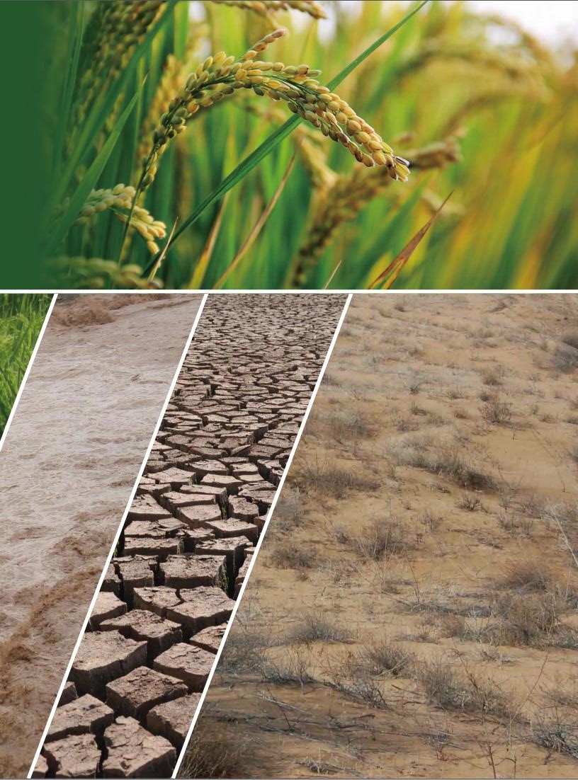
Achieving the set-out food security targets for countries of the B&R will require concerted global action, innovative and transformational means. Space science, technology, and applications, offer tools that significantly enhance the quality of information needed to support farmers, fishers, foresters, and policymakers in their effort to achieve sustainable food production, and apply disaster risk reduction measures, to increase their resilience against shocks and crises, such as droughts, floods, tsunamis, and other non-weather related shocks, like desertification, land degradation, and vegetation fires. The achieving on objectives of food security will benefit from the sharing of the fruits from CropWatch and Chinese observation technologies and the establishment of agronomic information community.
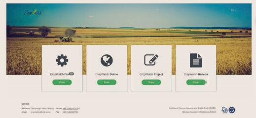
Upgrading and sharing of CropWatchIn 1998, CropWatch, a global agricultural monitoring system, was launched by the institute of remote sensing and digital earth of Chinese Academy of Sciences. After almost 20 years of improvement and development, CropWatch has established the hierarchy of the agricultural monitoring structure, which is composed of agroclimatic (photosynthetic active radiation, temperature, rain), agronomic (crop condition, drought, cropland, etc.), and PYA (crop production, yield, and area) subcomponents. In order to improve monitoring accuracy, CropWatch has divided the globe into 65 mapping and reporting units, 7 continental crop production zones, 31 major food exporters and importers based on the heterogeneity of global agricultural ecosystem and crop patterns. In 2013, CropWatch upgraded to the global agronomic cloud service platform, which includes CropWatch Processing, CropWatch Explore, CropWatch Analysis, and CropWatch Bulletin sub systems (Figure 1).
|
| Figure 1 CropWatch components |
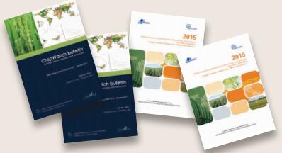
CropWatch provides an agronomic information dissemination service to the public through quarterly bulletins and monthly updates. In the period from 2013 to 2015, CropWatch team was responsible for the editing and publication of the report on remote sensing monitoring of global supply situation of maize, rice, wheat, and soybean (Figure 2).
|
| Figure 2 CropWatch Bulletin and 2015 report of global supply situation of Maize, Rice, Wheat and Soybean |
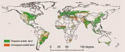
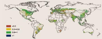
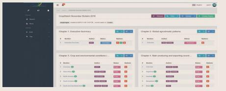
Using the cloud-based CropWatch platform, authorized partners can have synchronized access to agroclimatic (Figure 3), agronomic (Figure 4 and Figure 5), and PAY information with CropWatch team. On the other hand, authorized partners can make use of CropWatch Analysis (Figure 6) to independently analyze agricultural situations of particular regions according to the provided on-line monitoring results.

|
| Figure 3 Global map of rainfall anomaly departure from 15YA, July to October 2016 (%) |
|
| Figure 4 Global cropped and uncropped land map, July to October 2014 |
|
| Figure 5 Global maximum vegetation condition index map, July to October 2014 |
|
| Figure 6 CropWatch Analysis sub-system |
Since November 2013, CropWatch has released and shared global agronomic information for 139 countries around the world. Through the shared CropWatch cloud service platform, four (4) domestic research teams and partners from eight (8) foreign countries have been participating in the global agricultural remote sensing on-line analysis.
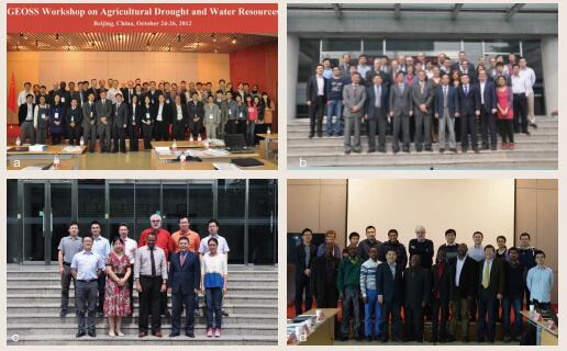
International cooperation in agronomic monitoringWith the mission to build the shared agronomic information community for B&R, CropWatch not only enhanced the cooperation with FAO, GEO GEOGLAM flagship, and also built the ties with food insecure countries from B&R and Africa. CropWatch team organized the GEOSS workshop on agricultural drought and water resources in October 24–26, 2012 in Beijing; CropWatch hosted the annual implementation meeting of GEOGLAM in October 21–22, 2014 in Beijing; The workshop on agronomic monitoring between Chinese Academy of Sciences and FAO was held in Beijing in May 21–22, 2015; CropWatch organized the workshop on the impact of agricultural development on food security and water vulnerability under climate change for Zambezi Basin in Beijing in January 21 to 23, 2016. In the meanwhile, CropWatch has signed the MOUs with Joint Research Center of European Commission (JRC/EC), Mongolia, Mozambique, Zambia, Egypt, and others.
With the support from UN-ESCAP, CAS-TWAS center of Excellence on Space Technology for Disaster Mitigation (SDIM), and National Remote Sensing Center of China, CropWatch acts as the node on Asia-Pacific regional drought monitoring mechanism of UN ESCAP, which provides technical support for regional drought monitoring. Since 2013, CropWatch not only designed and customized drought monitoring system for Mongolia and Sri Lanka, and also has trained more than 30 technical staffs from both countries and region. Particularly, taking on the job training, 3–4 technical staffs of Mongolia participated in the training 1–2 times every year, and work together with CropWatch team for 1–2 months each time, and technical staff of CropWatch help and guide them to do system design, data processing, indicator selection and evaluation, analysis and validation of the monitoring result. After 3 years, technical staffs of Mongolia not only understand the drought remote sensing monitoring methods, able to operate drought monitoring system, but also can optimize the method and process of drought monitoring system for local condition of Mongolia. Until now, the customized drought monitoring system has been transferred to and installed in Mongolia Remote Sensing Center and Arthur C. Clarke Institute for Modern Technologies (ACCIMT) of Sri Lanka, and both perform well. The process of capacity building not only educated the drought talents for Mongolia and Sri Lanka, improved the monitoring ability, but also promoted ownership and innovation for both countries on drought monitoring. This is a showcase.
Agriculture and food security working group of Digital Belt and RoadThrough the CropWatch cloud service platform, the agriculture and food security working group of the Digital Belt and Road (DBAR-AGRI) was inaugurated in Beijing in December 2016. The members of DBARAGRI are from China, GEO GEOGLAM flagship, BRICS, Belgium, The Netherlands, Mongolia, and so on. The co-chairs of DBAR-AGRI are Prof. Wu Bingfang from RADI/CAS and Shukri Ahmed from FAO, the advisor is Mr. He Changchui.
|
| Figure 7 International cooperation of CropWatch |
The mission of DBAR-AGRI is to enhance the capacity of food insecure countries of B&R in agronomic monitoring, to achieve food security, and to support decision-makers through developing and transferring CropWatch cloud service platform to partners.
The main objectives and activities of DBAR-AGRI include:
ⅰ. Provision and dissemination of agroclimatic and agronomic information across B&R for the Big Earth Observation Data Platform of DBAR;
ⅱ. Designing, developing, and transferring CropWatch to partners of B&R;
ⅲ. Calibration of CropWatch parameters through joint field trials or sharing of earth observation and in-situ data;
ⅳ. Training staff of B&R to operate CropWatch, and strengthening capacity-building in agricultural monitoring for their countries;
ⅴ. Establishment of a crop monitoring consortium under the framework of DBAR.
Next action of DBAR-AGRITo successfully establish the shared agronomic information community, CropWatch experts will further strengthen its data resources, algorithms, agronomic monitoring, and results sharing platforms through adopting the opportunity of latest technological innovations, such as cloud computing, mobile internet, deep learning and big data, and enriched by remote sensing data.
Firstly, CropWatch will enrich the indicators on agroclimatic, agronomic, PAY, and early warning through combination of the different cropping patterns and agricultural ecosystems, taking the user or region/country preference into account, and promote the capacity of information dissemination. Secondly, CropWatch will open the existing sub system to facilitate partners to carry out their own agronomic monitoring and analysis, including CropWatch Pro, CropWatch Online, CropWatch Project, and CropWatch bulletin. Additionally, CropWatch will open and share its algorithm and data resources, thus authorized partners will have the ability to customize the tools and data of their own system, which will significantly enhance the capacity of agronomic monitoring of food-insecure countries and strength their capacity of food governance, as an online store of Alibaba. Using web service, Docker, CropWatch will provide the communication port for existing agronomic monitoring system in B&R, avail them to the public and share the monitoring information, thereby create a fair environment to carry out joint monitoring and cross validation. At the same time, CropWatch will enhance agronomic analysis and information mining capacity through adopting machine and deep learning technologies and break through the bottleneck of agricultural forecasting and early warning. Meanwhile, CropWatch experts will transfer the technology to partners of food-insecure countries through organized international workshops, and training courses, so that partners of foodinsecure countries can independently operate agronomic monitoring system, and then grasp national agronomic information.
Interviews and Comments from Co-chair, Adviser, and Stakeholders
|
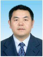
| Wu Bingfang is professor at the CAS Key Laboratory of Digital Earth Science, Chinese Academy of Sciences (CAS), award for nomination of first round National Hundred, Thousand and Ten Thousand Talent Project, co-leader of GEOSS Agriculture Task, expert panel leader of China node on AsiaPacific Regional drought monitoring of UN ESCAP, in 2016, principal investigator of the National Key Research and Development Program of China on climate change and adaptation. His research interests include agriculture remote sensing, water resource and management, and ecology remote sensing. Leading the development of crop monitoring and analysis with remote sensing since 1992, and built an operation global crop monitoring and analysis platform (CropWatch) in 1998 |
Comments from Wu Bingfang. Ensuring national food security is the most significant national mission of China and is also the shared vision of mankind. Since 1992, I started my research in the field of agricultural remote sensing, and established the global agricultural monitoring system in 1998. After nearly 20 years of improvement and development, CropWatch upgraded to global agricultural monitoring information cloud service platform, and became an important force to enhance the transparency of global agronomic information. Timely, accurate, and transparent agronomic information plays an important role in monitoring the supply situation of crops, as it helps to reduce potential loss and damage from natural disasters, and also impacts profoundly on food import and export trade decision-making. The major challenge faced by most food-insecure countries of the B&R and Africa is the paucity of capacity in agronomic information systems, suffering the challenges resulted from delayed, unreliable, and asymmetric agronomic information. The lack of agronomic monitoring systems in these countries results hinders the timely availability of information on national production and supply of crops. This, in turn, hampers informed decisions making with regard to supply gaps, import requirements, and/or estimates of losses resulting from hazards such as floods and drought. To own an independent agronomic information system is the shared vision of food insecure countries. As the largest agronomic products importers in the world, China also experienced the same situation as current food insecure countries, and profoundly understands the requirement of them. The responsibility of the global food security governance requires the joint work of global countries. As the team leader of CropWatch, I am glad to share the fruits of agronomic monitoring technologies and related information, and I will try my best to upgrade CropWatch platform, which will allow all food insecure countries participate the agronomic monitoring and significantly enhance the capacity of agronomic monitoring of food-insecure countries and strength their capacity of food governance, as setting an online store of Alibaba.

|
| Shukri Ahmed is currently the Deputy Strategic Programme Leader for one of FAO’s five Strategic Programmes “Increase the Resilience of Livelihoods to Threats and Crisis”. Until recently, he was the team leader for FAO’s Global Information and Early Warning System (FAO/GIEWS) in the Trade and Markets Division of FAO. His previous work experiences include a research assistant at the Centre for the Study of African Economies (CSAE) in the University of Oxford; Economic Statistician at the Central Statistical Authority in Addis Ababa, Ethiopia. Main areas of work and interest include disaster risk reduction and management, including index insurance; smallholder risk response analysis; disaster damage and loss estimation and analysis; food security monitoring and analysis together with related institutional issues in crisis, including protracted crisis. Shukri has a D.Phil. and a M.Sc. in Agricultural Economics from the University of Oxford and a BA in Economics from the University of Addis Ababa |
Comments from Shukri Ahmed. Agriculture forms the basis of livelihoods in most developing countries. However, it is subject to several challenges, from increasing pressure on soils, water availability, vagaries of weather and climate to unsustainable farming practices. Farmers often face challenges because of water shortages, expensive fertilizers, and other chemical products, which also have a negative impact on the environment. Satellite-based imagery can be helpful in pinpointing problematic areas and drive specific hot-spot surveys. Also, they can highlight trend anomalies when comparing different years. When these data are integrated into agronomic models, crop yields can be forecasted. At continental and global levels, the capability of anticipating variations in crop yield is the key to anticipating swings in the markets and therefore enhancing the governance of 'price and food' crises. Satellites also support the timely and accurate monitoring of the state of agricultural land use and changes at national and regional levels. Broadening the knowledge base and technical knowhow to developing countries concerning the role of geospatial information promotes shared prosperity and can significantly contribute to the identification of the next development frontiers. As such, tools developed through systems like CropWatch are essential to translate the vast data and information from satellites for effective and meaningful translation to action. This supports more informed, evidence-based, and data-driven decision making. They allow the achievement of goals of Open Data, Open Knowledge, and Open Solutions and reinforce technical assistance and capacity building activities dedicated to supporting the users of remote sensing and other spatial data in developing countries. All in all, for such potential to be realized, it requires the institutionalization and promotion of shared community of agricultural information. Tested experiences from systems such as CropWatch will go a long way to facilitate the transfer of knowledge and can provide a formidable medium through which the domestication of such sophisticated and advanced tools are achieved.
|
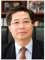
| He Changchui, academician of international Eurasian Academy of Sciences. Until recently, he was the Former Deputy Director-General of FAO. His previous work experiences include Assistant Director–General and Chief Executive Officer of the AsiaPacific Region, Director of the Environment and Natural Resources Division of the Department of Sustainable Development, Director of the Remote Sensing Programme of the Asia-Pacific Region of United Nations Economic and Social Commission for Asia and the Pacific and United Nations Development Programme. He has been paying attention on the global food security for more than 30 years and has made an important contribution to promote food security governance in the world. |
Comments from He Changchui. "The Silk Road Economic Belt and the 21st Century Maritime Silk Road" ("B&R") Initiative proposed by Xi Jinping, the President of China, provides a unique opportunity for boosting economic development in the related countries and achieving SDGs by 2030. Most of the countries along the "B&R" are developing ones with agriculture as a dominant economic sector, especially it accounts for more than 25% of GDP and 40% of employment in the case of many countries in Southeast Asia, South Asia, Central Asia, and Africa. Accordingly, giving a priority consideration to the agriculture sector and food security will be crucial to ensure an overall success of the B&R Initiative. One of the key constraints encountered in global food security governance is the enlarging information gap and information asymmetry, partially due to the monopoly of technology for monitoring global production and manipulation of market information by a few advanced countries. Lessons learnt from the 2007/08 global food crisis rang an alarming bell for the world community to call for timely monitoring global crop production and making agricultural market information more open and transparent, available to and assessable by developing nations. Hence the G20 requested the development of Agricultural Market Information System (AMIS) host by UN FAO and global agriculture monitoring (GEOGLAM) host by GEO. China is an active player and important contributor to the GEOGLAM and AMIS. With its advanced satellite remote sensing technology and high resolution data as well as the packages of software and methodology developed by the Chinese scientists, China has, in parallel with the United States and European Union, matured as one of the three major world leaders in global monitoring of agricultural production and providing up-todate agronomic market information. Against the current backdrop of anti-globalization noise and concerns over the trade protectionism, a need is increasingly envisaged to forge an agronomic information community to promote an more open, transparent and balanced market information available for sharing, as this is the only way to keep the often deliberately distorted world major agricultural commodity market information on check and to safeguard the progress of food security in developing countries, which are often most vulnerable to the instability of the world food market. China as the biggest developing country with fairly advanced capability for global monitoring of agricultural production will naturally be expected by the world community to take the lead in promoting and developing an interest sharing agronomic information community within the framework of the "B&R". Such a community should adopt an open, consultative, inclusive, and mutually beneficial approach, involving stockholders who are willing to participate and contribute. Technically, such a community can take the advantage of the CropWatch programme that has been developed by CAS/RADI in cloud environment, since it has followed an open-system paradigm and played a key role in support of GEOGLAM and AMIS as well as a large numbers of international users. Nevertheless, to operationalize the CropWatch system along the "B&R", it requires necessary expansion so as to enhance capacity development, and enable technology transfer to B&R participating countries. It also requires further research and technological development to improve the operationalist of the system by incorporating the contemporary technology of internet+, cloud computation, and computer deep learning and big data for better interactive connectivity along the B&R nations.
|
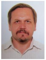
| Igor Savin, corresponding member of Russian Academy of Sciences, professor of People's Friendship University of Russia, and of Moscow State University, Vice-Director of V.V. Dokuchaev Soil Science Institute in Moscow (Russia). He has participated in creating of crop growth monitoring and yield forecasting system of the European Commission (MARS Project), as well as in building of the Satellite System of Crop Monitoring for Russian Ministry of Agriculture. Main areas of work and interest include soil mapping, monitoring, and evaluation based on remote sensing data, crop growth modeling and monitoring, crop yield forecasting. Igor Savin has a Candidate of Science degree (Ph.D. eq.) in geography from Moscow State University, and Doctor of Science degree in agriculture from V.V. Dokuchaev Soil Science Institute |
Comments from Igor Savin. The possibilities for the production of agricultural products depend on many factors. The most significant of these for rainfed agriculture is the climate. When crops are irrigated, the presence of water is very important. Global climate changes often lead to unpredictable weather behavior that significantly affect crop yields. In addition, global climate change, along with irrational land use, leads to accelerated soil degradation and loss of their fertility. All this significantly complicates the possibilities of traditional methods of monitoring crops and forecasting crop yields. The rapid development of satellite technology in recent decades has led to the emergence of remote sensing based crop monitoring systems. These systems allow one quickly obtain information about the state of soils and crops and on its basis, receive independent assessment and forecasts of the crop yield. Such systems can be built only if there are large financial investments and a priori agronomic knowledge. At present, such systems exist in Europe, in China, in the USA, and in Russia. All these systems carry out satellite crop monitoring not only at the country level, but also include other countries. But in most cases, the results of operational monitoring are not available to the user both inside the country and especially abroad. The attempt to create a fully open satellite monitoring system based on the Chinese experience (CropWatch) is very interesting and in demand. Ideally, the system should give the user, in a simple way, crop status indicators in any field, derived from satellite data. The system should also have the opportunity to present monitoring results in an aggregated form to the level of individual countries or regions. By matching this information with local agronomic knowledge, the user will have the opportunity to independently assess the situation and build crop forecasts. The system should include as well a block for monitoring the state of soils and their degradation. This information will make it possible to build algorithms for analyzing satellite data in more reliable way, and more reliably predict the yield. The creation of such a system is equally necessary for large countries–food producers, as well as for countries that lack food. The openness of monitoring results will allow more reliable planning of assistance to needy countries and regions and more confidently regulate food markets. Russia has accumulated extensive experience in creating of remote sensing based crop monitoring systems, as well as holds a large array of local agronomic knowledge for both its country and the countries of Central Asia—the former Soviet republics. Therefore, it would be interesting to take part in the promotion of the proposed initiative.


